
Dattagalli
Dattagalli | |
|---|---|
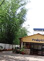
 Temple at Dattagalli bus terminus, Mysore | |
| Coordinates: 12°17′06″N 76°36′07″E / 12.28512°N 76.60187°E | |
| Country | India |
| State | Karnataka |
Dattagalli is a small urban area on the southeast of the city of Mysore, the second largest city in the state of Karnataka, India.
Location
Dattagalli is near to Kuvempu Nagar and Andolan Circle.
Education
There are two prominent schools in this area, the Kautilya Vidyalaya (12°16′28″N 76°36′39″E / 12.274306°N 76.610927°E) and the Supreme Public School (12°16′42″N 76°36′34″E / 12.278325°N 76.609447°E). One Ayurvedic Hospital (12°17′51″N 6°39′15″E / 12.297596°N 6.6542°E) is also situated in Dattagalli.
See also
Image Gallery
-
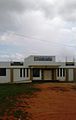
 Kautilya school
 -
 Rotary School
 -
 Somanath Road
 -
 Nethaji Circle


12°18′25″N 76°37′18″E / 12.306897°N 76.621685°E
This article related to a location in Mysore district, Karnataka, India is a stub. You can help Wikipedia by expanding it. |