Domajinci
Appearance
Domajinci | |
|---|---|
 | |
| Coordinates: 46°44′16.25″N 16°2′36.07″E / 46.7378472°N 16.0433528°E | |
| Country | |
| Traditional region | Prekmurje |
| Statistical region | Mura |
| Municipality | Cankova |
| Area | |
| • Total | 3.46 km2 (1.34 sq mi) |
| Elevation | 219.2 m (719.2 ft) |
| Population (2002) | |
| • Total | 281 |
| [1] | |
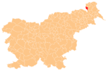
Domajinci (pronounced [dɔmaˈjiːntsi]; Hungarian: Dombalja,[2] Prekmurje Slovene: Domaginci[3]) is a village in the Municipality of Cankova in the Prekmurje region of northeastern Slovenia.
There is a small chapel in the settlement. It was built in 1880.[4]
References
- ^ Statistical Office of the Republic of Slovenia
- ^ Radkersburg und Luttenberg (map, 1:75,000). 1894. Vienna: K.u.k. Militärgeographisches Institut.
- ^ M. Koletnik: O toponimih v občini Cankova, Življenje in delo Jožefa Borovnjaka, Maribor 2008. ISBN 978-961-6320-49-8 p. 274.
- ^ Slovenian Ministry of Culture register of national heritage reference number 20339
External links


