
Drahelčice
You can help expand this article with text translated from the corresponding article in Czech. (July 2009) Click [show] for important translation instructions.
|
Drahelčice | |
|---|---|
Municipality and village | |
 | |
 Flag  Coat of arms | |
 | |
| Country | |
| Region | Central Bohemian Region |
| District | Prague-West District |
| Area | |
| • Total | 1.84 sq mi (4.77 km2) |
| Elevation | 1,204 ft (367 m) |
| Population (2011) | |
| • Total | 503 |
| • Density | 270/sq mi (110/km2) |
| Time zone | UTC+1 (CET) |
| • Summer (DST) | UTC+2 (CEST) |
Drahelčice is a village and municipality in Prague-West District in the Central Bohemian Region of the Czech Republic.
Gallery
-
 The chapel
 -
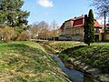 Radotínský Creek


References
- This article was initially translated from the Czech Wikipedia.
Wikimedia Commons has media related to Drahelčice.
50°02′N 14°12′E / 50.033°N 14.200°E