East India Docks

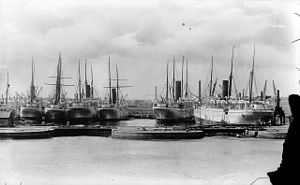
The East India Docks was a group of docks in Blackwall, east London, north-east of the Isle of Dogs. Today only the entrance basin and listed perimeter wall remain visible.
History

Following the successful creation of the West India Docks which opened in 1802, an Act of Parliament in 1803 set up The East India Dock Company, promoted by the Honourable East India Company. Joseph Cotton was chairman of the Dock Company from 1803.[1]
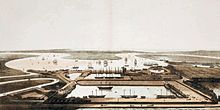
The docks, designed by engineer Ralph Walker,[2] were located to the north-east of the West India Docks. They were based on the existing Brunswick Dock, which had been used for fitting out and repairing ships as part of Blackwall Yard. The Brunswick Dock, which had originally been connected directly to the Thames to the south, became the Export Dock. To the north the company built a larger 18-acre (7.3 ha) Import Dock. Both were connected to the Thames via an eastern entrance basin.
The company rapidly became profitable through its trade in commodities such as tea, spices, indigo, silk and Persian carpets. The tea trade alone was worth £30m a year. The docks spawned further local industry, with spice merchants and pepper grinders setting up around the dock to process goods.

In 1838 the East and West India companies merged. In 1886, in the last act of a ruinous game of leapfrog with the London & St Katharine Dock Company, they built the Tilbury Docks. In 1909 the docks were taken over by the Port of London Authority, along with the other enclosed docks.
While much smaller than the West India Docks or the later Royal Docks, the East India Docks could still handle East Indiamen of 1000 tons and up to 250 ships at one time. However the advent of steam power and larger ships reduced the importance of this dock and by the mid-20th century most of the trade had left.

The docks played a key role in the Second World War as a location for constructing the floating Mulberry harbours used by the Allies to support the D-Day landings in France.
After the war, during which all the docks were badly damaged, the East India Docks were confined to occasional Channel Islands traffic and to the maintenance of equipment including dredgers.
Brunswick Wharf Power Station was built on the site of the Export Dock in stages between 1946 and 1956. This was a monumental brick structure with fluted concrete chimneys after the style of Gilbert Scott's designs for Battersea and Bankside. It ceased generation in 1984 and was demolished in the late 1980s.
In 1967 the docks were the first of the London docks to close.
East India Docks today

Today the docks have been mostly filled in. Only the entrance basin remains, as a wildlife refuge and an attractive local amenity. The area is predominantly residential with several major developments either complete or under construction around it. One, the Leamouth Peninsula, will form the western boundary of the dock, and is intended to be completed by 2012.
The names of the streets on the site of the former docks reflect the names of some of the goods traded here: Clove Crescent, Nutmeg Lane, Coriander Avenue, Oregano Drive, Rosemary Drive and Saffron Avenue.
References
- Lubbock, Basil (1922). Blackwall Frigates. available online at [1]
- Robert Wigram; Henry Green (1881). Chronicles of Blackwall yard. available online at [2]
- ^ Bowen, H. V. "Cotton, Joseph". Oxford Dictionary of National Biography (online ed.). Oxford University Press. doi:10.1093/ref:odnb/6421. (Subscription or UK public library membership required.)
- ^ Skempton, A.W. (2002) A Biographical Dictionary of Civil Engineers in Great Britain and Ireland, pp. 757-758
