
Elcho (CDP), Wisconsin
Elcho, Wisconsin | |
|---|---|
Unincorporated community | |
 Looking north at downtown Elcho | |
 Elcho, Wisconsin | |
| Coordinates: 45°26′09″N 89°11′00″W / 45.43583°N 89.18333°W | |
| Country | United States |
| State | Wisconsin |
| County | Langlade |
| Area | |
| • Total | 1.199 sq mi (3.11 km2) |
| • Land | 1.063 sq mi (2.75 km2) |
| • Water | 0.136 sq mi (0.35 km2) |
| Elevation | 1,631 ft (497 m) |
| Population (2010) | |
| • Total | 339 |
| • Density | 280/sq mi (110/km2) |
| Time zone | UTC-6 (Central (CST)) |
| • Summer (DST) | UTC-5 (CDT) |
| ZIP code | 54428 |
| Area code(s) | 715 & 534 |
| GNIS feature ID | 1564493[1] |
Elcho is an unincorporated census-designated place located in the town of Elcho, Langlade County, Wisconsin, United States. Elcho is located on U.S. Route 45 and Wisconsin Highway 47 16.5 miles (26.6 km) southwest of Crandon. Elcho has a post office with ZIP code 54428.[2] As of the 2010 census, its population was 339.[3]
Images
-
 Elcho School
 -
 Elcho sign on U.S. Route 45
 -
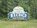 Welcome sign
 -
 Fire and rescue building


References
Municipalities and communities of Langlade County, Wisconsin, United States | ||
|---|---|---|
| City |  | |
| Village | ||
| Towns | ||
| CDPs | ||
| Unincorporated communities | ||
This article about a location in Langlade County, Wisconsin is a stub. You can help Wikipedia by expanding it. |