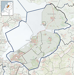
Ens, Netherlands
Ens | |
|---|---|
 Church | |
| Coordinates: 52°38′13″N 5°49′32″E / 52.63694°N 5.82556°E | |
| Country | Netherlands |
| Province | Flevoland |
| Municipality | Noordoostpolder |
| Population (1 October 2010) | 3,036 |
Ens (52°38′N 5°50′E / 52.633°N 5.833°E) is a village in the Dutch province of Flevoland. It is a part of the municipality of Noordoostpolder, and lies about 10 km southeast of Emmeloord.
In 2001, Ens had 2106 inhabitants. The built-up area of the village was 0.57 km², and contained 846 residences.[1]
Public transportation
There is no railway station in Ens, but the nearest station is Kampen. There is a regular bus service 141 (Zwolle - Kampen - Ens - Emmeloord - Urk).
References
- ^ Statistics Netherlands (CBS), Bevolkingskernen in Nederland 2001 "Archived copy". Archived from the original on 2007-01-24. Retrieved 2007-01-24.
{{cite web}}: Unknown parameter|deadurl=ignored (|url-status=suggested) (help)CS1 maint: archived copy as title (link). Statistics are for the continuous built-up area.

