
Etosha National Park
| Etosha National Park | |
|---|---|
| Lua error in Module:Location_map at line 526: Unable to find the specified location map definition: "Module:Location map/data/LocationNamibia.png" does not exist. | |
| Location | Namibia |
| Area | 22,270 km² |
| Established | June 20, 1975 |
| Governing body | Ministry of Environment and Tourism |


Etosha National Park is a national park in the Kunene Region of northwestern Namibia. The park shares boundaries with the regions of Oshana, Oshikoto and Otjozondjupa.
The Etosha Gates are named Otjovasandu Gate, Anderson Gate, Namutoni Gate, and Von Lindequist Gate.
History
Etosha was first established in 1907, when Namibia was a German colony known as South West Africa. At the time, the park’s original 100,000 km² (38,500 mile²) made it the largest game reserve in the world. Due to political changes since its original establishment, the park is now slightly less than a quarter of its original area, but still remains a very large and significant area in which wildlife is protected.
Fauna and flora
The Etosha Pan dominates the park. The salt pan desert is roughly 130 km long and as wide as 50 km in places. The hypersaline conditions of the pan limit the species that can permanently inhabit the pan itself; occurrences of extremophile micro-organisms are present, which species can tolerate the hypersaline conditions.(C.Michael Hogan. 2010) The salt pan is usually dry, but fills with water briefly in the summer, when it attracts pelicans and flamingos in particular. Perennial springs attract a variety of animals and birds throughout the year, including the endangered Black Rhinoceros and the endemic Black-faced Impala.
In the dry season, winds blowing across the salt pan pick up saline dust and carry it across the country and out over the southern Atlantic. This salt enrichment provides minerals to the soil downwind of the pan on which some wildlife depends, though the salinity also creates challenges to farming.
The Etosha Pan was one of several sites throughout southern Africa in the Southern African Regional Science Initiative (SAFARI 2000). Using satellites, aircraft, and ground-based data from sites such as Etosha, partners in this program collected a wide variety of data on aerosols, land cover, and other characteristics of the land and atmosphere to study and understand the interactions between people and the natural environment.
A long fence has been erected along the park’s 850 km boundary to control the spreading of disease. The animals concentrate around the new waterholes, resulting in excessive grazing in their vicinity. Fifty waterholes have been constructed to attract animals and so improve the viewing prospect for visitors.
See also
Gallery
-

-

-

-
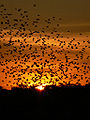 Sunset at Etosha National Park

.jpg)
.jpg)

References
- "Etosha National Park, Namibia". NASA Earth Observatory.
- C.Michael Hogan. 2010. Extremophile. eds. E.Monosson and C.Cleveland. Encyclopedia of Earth. National Council for Science and the Environment, Washington DC.