Ewanrigg
Appearance
| Ewanrigg | |
|---|---|
 Ewanrigg | |
Location within Cumbria | |
| Population | 3,447 (2011) |
| OS grid reference | NY039355 |
| Civil parish | |
| District | |
| Shire county | |
| Region | |
| Country | England |
| Sovereign state | United Kingdom |
| Post town | MARYPORT |
| Postcode district | CA15 |
| Dialling code | 01900 |
| Police | Cumbria |
| Fire | Cumbria |
| Ambulance | North West |
| UK Parliament | |
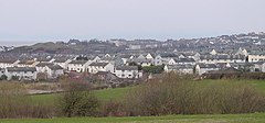
Ewanrigg is a suburb of the town of Maryport, located in the Allerdale District in the county of Cumbria, England. Ewanrigg is a residential area and has a post office, a school and a few places of worship. An electoral ward in the same name exists. This ward stretches south east to Broughton Moor with a total population taken at the 2011 census of 3,447.[1]
Location
It is near the River Ellen and is only about a mile away from the estuary, which goes out into the Irish Sea.
Transport
For transport there is the A594 road going through the settlement and the A596 road nearby; Maryport railway station is also nearby. Other suburbs of Maryport include Ellenborough, Netherton and Glasson.
References
- ^ "Ward population 2011". Retrieved 17 June 2015.
- Philip's Street Atlas Cumbria (page 182)

