Eygalayes
- Asturianu
- 閩南語 / Bân-lâm-gú
- Català
- Cebuano
- Deutsch
- Español
- Esperanto
- Euskara
- Français
- Bahasa Indonesia
- Italiano
- Latina
- Lombard
- Magyar
- Malagasy
- Bahasa Melayu
- Nederlands
- Нохчийн
- Occitan
- Oʻzbekcha / ўзбекча
- Piemontèis
- Polski
- Português
- Română
- Slovenčina
- Српски / srpski
- Srpskohrvatski / српскохрватски
- Svenska
- Татарча / tatarça
- Basa Ugi
- Українська
- Vèneto
- Tiếng Việt
- Winaray
- 粵語
- Zazaki
- 中文
Tools
Actions
General
Print/export
Print/export
In other projects
From Wikipedia, the free encyclopedia
This is an old revision of this page, as edited by Tbennert (talk | contribs) at 03:51, 28 October 2016 (→top: Rhône-Alpes to Auvergne-Rhône-Alpes using AWB). The present address (URL) is a permanent link to this revision, which may differ significantly from the current revision.
Place in Auvergne-Rhône-Alpes, France
Eygalayes | |
|---|---|
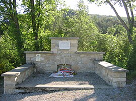
 Monument to Resistance fighters | |
| Country | France |
| Region | Auvergne-Rhône-Alpes |
| Department | Drôme |
| Arrondissement | Nyons |
| Canton | Séderon |
| Intercommunality | Canton de Ribiers Val de Méouge |
| Government | |
| • Mayor (2008–2014) | Josette Fournier |
| Area 1 | 17.97 km2 (6.94 sq mi) |
| Population (2008) | 70 |
| • Density | 3.9/km2 (10/sq mi) |
| Time zone | UTC+01:00 (CET) |
| • Summer (DST) | UTC+02:00 (CEST) |
| INSEE/Postal code | 26126 /26560 |
| Elevation | 722–1,484 m (2,369–4,869 ft) |
| 1 French Land Register data, which excludes lakes, ponds, glaciers > 1 km2 (0.386 sq mi or 247 acres) and river estuaries. | |
Eygalayes is a commune in the Drôme department in the Auvergne-Rhône-Alpes region in southeastern France.
Population
| Year | Pop. | ±% |
|---|---|---|
| 1911 | 259 | — |
| 1962 | 98 | −62.2% |
| 1968 | 106 | +8.2% |
| 1975 | 89 | −16.0% |
| 1982 | 80 | −10.1% |
| 1990 | 76 | −5.0% |
| 1999 | 76 | +0.0% |
| 2008 | 70 | −7.9% |
See also
References
Wikimedia Commons has media related to Eygalayes.
Retrieved from "https://en.wikipedia.org/w/index.php?title=Eygalayes&oldid=746555139"
Hidden categories:
- Articles with short description
- Short description is different from Wikidata
- Pages using infobox settlement with image map1 but not image map
- Pages using infobox settlement with no coordinates
- Pages using infobox French commune with unknown parameters
- France articles requiring maintenance
- Commons category link is on Wikidata
- All stub articles
- Pages using the Kartographer extension

