
File:02705jfLight Mall Light Residences SMDC EDSA Boni Pioneer Woodlands Mandaluyong Cityfvf 21.jpg

Size of this preview: 800 × 600 pixels. Other resolutions: 320 × 240 pixels | 640 × 480 pixels | 1,024 × 768 pixels | 1,280 × 960 pixels | 2,560 × 1,920 pixels | 4,608 × 3,456 pixels.
Original file (4,608 × 3,456 pixels, file size: 6.02 MB, MIME type: image/jpeg)
| This is a file from the Wikimedia Commons. Information from its description page there is shown below. Commons is a freely licensed media file repository. You can help. |
Summary
| Description |
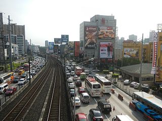
English: Light Mall - Light Residences SMDC (EDSA, Mandaluyong City) Light Residences 14°34'25"N 121°2'56"E SM Development Corporation 14°34'28"N 121°2'58"E Pioneer Woodlands 14°34'21"N 121°2'55"E Empire East Forum Robinsons
Robinsons Place Pioneer 14°34'15"N 121°2'51"E Robinsons_Malls Robinsons Cybergate Mandaluyong City Boni MRT Station along EDSA (road) Epifanio de los Santos Avenue Highway 54, Boni Avenue and Pioneer Street Pioneer Bridge 15 metric tons load limit 6 meters length K0012+235+112 corner Sheridan Street 14°34'26"N 121°3'12"E in the List of barangays of Metro Manila, Barangay Barangaka Ilaya, beside Buayang Bato 14°34'10"N 121°2'57"E beside Highway Hills 14°34'47"N 121°3'3"E Mandaluyong City (Note: Judge Florentino Floro, the owner, to repeat, Donor Florentino Floro of all these photos hereby donate gratuitously, freely and unconditionally all these photos to and for Wikimedia Commons, exclusively, for public use of the public domain, and again without any condition whatsoever). |
| Date | |
| Source | Own work |
| Author | Judgefloro |
| Camera location | | View this and other nearby images on: OpenStreetMap |
|---|
Pioneer Woodlands 14°34'21"N 121°2'55"E
Licensing
I, the copyright holder of this work, hereby publish it under the following license:
| This file is made available under the Creative Commons CC0 1.0 Universal Public Domain Dedication. | |
| The person who associated a work with this deed has dedicated the work to the public domain by waiving all of their rights to the work worldwide under copyright law, including all related and neighboring rights, to the extent allowed by law. You can copy, modify, distribute and perform the work, even for commercial purposes, all without asking permission.
|
File history
Click on a date/time to view the file as it appeared at that time.
| Date/Time | Thumbnail | Dimensions | User | Comment | |
|---|---|---|---|---|---|
| current | 12:22, 11 November 2016 | | 4,608 × 3,456 (6.02 MB) | Judgefloro | User created page with UploadWizard |
File usage
The following pages on the English Wikipedia use this file (pages on other projects are not listed):
Global file usage
The following other wikis use this file:
- Usage on es.wikipedia.org
- Usage on ms.wikipedia.org
- Usage on th.wikipedia.org
- Usage on www.wikidata.org