Jump to content

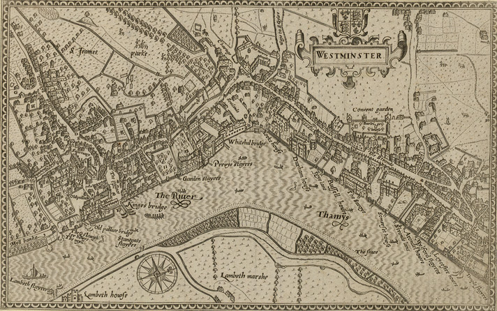
File:1593 Norden's map of Westminster surveyed and publ 1593 (1).jpg

Page contents not supported in other languages.
This is a file from the Wikimedia Commons
From Wikipedia, the free encyclopedia

1593_Norden's_map_of_Westminster_surveyed_and_publ_1593_(1).jpg (712 × 446 pixels, file size: 193 KB, MIME type: image/jpeg)

Summary

Norden's map of Westminster, surveyed and published 1593. From the Crace Collection at the British Library. The Strand, which is the main road on the right hand side of the map, was in its heyday as the favoured residence of the elite of the English aristocracy, and several of the major mansions located there are labelled on the map.

Description Norden's map of Westminster.
Date
Source Crace Collection at the British Library.
Author Norden
Permission
(Reusing this file)
Public domain

This work is in the public domain in its country of origin and other countries and areas where the copyright term is the author's life plus 100 years or fewer.


You must also include a United States public domain tag to indicate why this work is in the public domain in the United States.
This file has been identified as being free of known restrictions under copyright law, including all related and neighboring rights.

Captions

Add a one-line explanation of what this file represents

Items portrayed in this file

depicts

image/jpeg

448daabd2a87fc70568df685dfac5d9d01be43f1

197,910 byte

446 pixel

712 pixel

File history

Click on a date/time to view the file as it appeared at that time.

Date/TimeThumbnailDimensionsUserComment
current19:10, 16 February 2006Thumbnail for version as of 19:10, 16 February 2006712 × 446 (193 KB)Merchbow~commonswikiNorden's map of Westminster, surveyed and published 1593. From the Crace Collection at the British Library. Category:Maps of London category:City of Westminster

The following 3 pages use this file:

Global file usage

The following other wikis use this file: