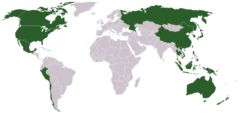
File:APECMitgliedsstaaten.png
Appearance

Size of this preview: 800 × 370 pixels. Other resolutions: 320 × 148 pixels | 640 × 296 pixels | 1,357 × 628 pixels.
Original file (1,357 × 628 pixels, file size: 35 KB, MIME type: image/png)
File history
Click on a date/time to view the file as it appeared at that time.
| Date/Time | Thumbnail | Dimensions | User | Comment | |
|---|---|---|---|---|---|
| current | 19:30, 25 March 2018 |  | 1,357 × 628 (35 KB) | Maphobbyist | Montenegro and South Sudan borders |
| 12:43, 4 July 2006 |  | 1,357 × 628 (46 KB) | Satesclop | ||
| 12:02, 29 August 2005 |  | 1,357 × 628 (25 KB) | ChongDae | This image was copied from wikipedia:en. The original description was: World Map APEC member states Author: St. Krekeler {{GFDL}} {| border="1" ! date/time || username || edit summary |---- | 08:24, 6 August 2005 || 195.136.67.69 || <nowiki></nowiki> |
File usage
The following 2 pages use this file:
Global file usage
The following other wikis use this file:
- Usage on bcl.wikipedia.org
- Usage on de.wikipedia.org
- Usage on es.wikipedia.org
- Usage on es.wikinews.org
- Usage on et.wikipedia.org
- Usage on gl.wikipedia.org
- Usage on hu.wikipedia.org
- Usage on ja.wikipedia.org
- Usage on ja.wikinews.org
- Usage on kk.wikipedia.org
- Usage on ky.wikipedia.org
- Usage on ms.wikipedia.org
- Usage on pl.wikinews.org
- Usage on ro.wikipedia.org
- Usage on sk.wikipedia.org
- Usage on sv.wikipedia.org
- Usage on tl.wikipedia.org
- Usage on tr.wikipedia.org
- Usage on vi.wikipedia.org
- Usage on zh-min-nan.wikipedia.org


