
File:Albany-Gledhow map.png
No higher resolution available.
Albany-Gledhow_map.png (242 × 175 pixels, file size: 9 KB, MIME type: image/png)
| This is a file from the Wikimedia Commons. Information from its description page there is shown below. Commons is a freely licensed media file repository. You can help. |
Summary
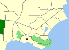
| Description | Map of the suburb of Gledhow in Albany, Western Australia. |
| Date | |
| Source | Own work |
| Author | Orderinchaos78 |
Licensing
| I, the copyright holder of this work, release this work into the public domain. This applies worldwide. In some countries this may not be legally possible; if so: I grant anyone the right to use this work for any purpose, without any conditions, unless such conditions are required by law. |
File history
Click on a date/time to view the file as it appeared at that time.
| Date/Time | Thumbnail | Dimensions | User | Comment | |
|---|---|---|---|---|---|
| current | 03:37, 11 May 2007 | | 242 × 175 (9 KB) | Orderinchaos | {{Information |Description=Map of the suburb of w:Gledhow, Western Australia in w:Albany, Western Australia, w:Western Australia. |Source=self-made |Date=11 May 2007 |Author=User:Orderinchaos78 |Permission= |other_versions= }} [[Catego |
File usage
No pages on the English Wikipedia use this file (pages on other projects are not listed).
Global file usage
The following other wikis use this file:
- Usage on de.wikipedia.org