
File:Apaporis drainage basin map-fr.svg

Size of this PNG preview of this SVG file: 458 × 600 pixels. Other resolutions: 183 × 240 pixels | 366 × 480 pixels | 586 × 768 pixels | 782 × 1,024 pixels | 1,564 × 2,048 pixels | 1,101 × 1,442 pixels.
Original file (SVG file, nominally 1,101 × 1,442 pixels, file size: 1.47 MB)
| This is a file from the Wikimedia Commons. Information from its description page there is shown below. Commons is a freely licensed media file repository. You can help. |
Summary
| Description |
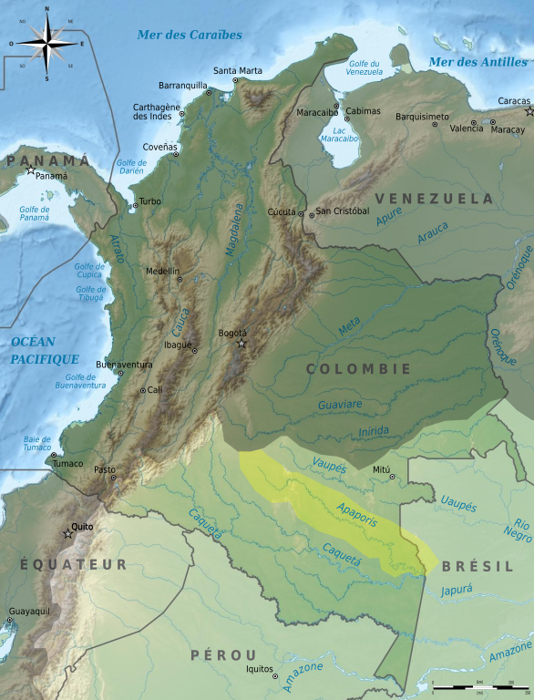
Français : Carte du bassin versant de l'Apaporis à l'intérieur du bassin versant de l'Amazone, sur une carte de Colombie. Limites approximatives ! |
||||
| Date | 2011/03/06 - 6 mars 2011 | ||||
| Source | Own work ; travail personnel from File:Colombia relief location map.jpg (Grundkarte Shadowxfox, Relief Alexrk2 + SRTM3, ETOPO1) | ||||
| Author | Bourrichon - fr:Bourrichon | ||||
| Permission (Reusing this file) |
I, the copyright holder of this work, hereby publish it under the following licenses:
This file is licensed under the Creative Commons Attribution-Share Alike 3.0 Unported, 2.5 Generic, 2.0 Generic and 1.0 Generic license.
You may select the license of your choice. |


|
This SVG file contains embedded text that can be translated into your language, using any capable SVG editor, text editor or the SVG Translate tool. For more information see: About translating SVG files. |
This W3C-unspecified vector image was created with Inkscape .
File history
Click on a date/time to view the file as it appeared at that time.
| Date/Time | Thumbnail | Dimensions | User | Comment | |
|---|---|---|---|---|---|
| current | 16:53, 6 March 2011 | | 1,101 × 1,442 (1.47 MB) | Bourrichon | {{Information |Description= {{fr|Carte du bassin versant de l'fr:Apaporis à l'intérieur du bassin versant de l'Amazone, sur une carte de Colombie. Limites approximatives !}} |Source={{Own}} ; travail |
File usage
The following page uses this file:
Global file usage
The following other wikis use this file:
- Usage on es.wikipedia.org
- Usage on fr.wikipedia.org
- Usage on hr.wikipedia.org
- Usage on no.wikipedia.org
- Usage on uk.wikipedia.org
- Usage on zh.wikipedia.org