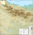
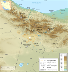
File:Carte Topo Region Teheran.png
Appearance

Size of this preview: 567 × 599 pixels. Other resolutions: 227 × 240 pixels | 454 × 480 pixels | 727 × 768 pixels | 969 × 1,024 pixels | 2,176 × 2,300 pixels.
Original file (2,176 × 2,300 pixels, file size: 3.89 MB, MIME type: image/png)
File history
Click on a date/time to view the file as it appeared at that time.
| Date/Time | Thumbnail | Dimensions | User | Comment | |
|---|---|---|---|---|---|
| current | 22:11, 30 January 2011 |  | 2,176 × 2,300 (3.89 MB) | Fabienkhan | {{Information |Description ={{en|1=Topographic map in French of the Tehran area in Iran.<br/>''Note :'' The shaded relief is a raster image embedded in the SVG file.}} {{fr|1=Carte topographique en français de la région de [[:fr:Téhé |
File usage
The following page uses this file:
Global file usage
The following other wikis use this file:
- Usage on ar.wikipedia.org
- Usage on ckb.wikipedia.org
- Usage on cs.wikipedia.org
- Usage on fa.wikipedia.org
- Usage on fr.wikipedia.org
- Usage on incubator.wikimedia.org
- Usage on mg.wikipedia.org
- Usage on mt.wikipedia.org
- Usage on my.wikipedia.org
- Usage on vi.wikipedia.org
- Usage on www.wikidata.org


