Jump to content

File:Georgia Ave DC.PNG

Page contents not supported in other languages.
This is a file from the Wikimedia Commons
From Wikipedia, the free encyclopedia

Georgia_Ave_DC.PNG (323 × 326 pixels, file size: 13 KB, MIME type: image/png)

Summary

Description
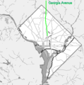
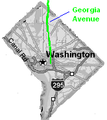
English: Grayscale map of Washington, D.C. showing location of Georgia Avenue in green. Created by the uploader from an image off the tiger map server from the U.S. Census.
Date 26 February 2006 (original upload date)
Source Transferred from en.wikipedia to Commons by Ronhjones.
Author Rfc1394 at en.wikipedia

Licensing

Public domain
This image or file is a work of a United States Census Bureau employee, taken or made as part of that person's official duties. As a work of the U.S. federal government, the image is in the public domain.

English  español  日本語  македонски  മലയാളം  português do Brasil  русский  українська  עברית  +/−


Public domain This work has been released into the public domain by its author, Rfc1394 at English Wikipedia. This applies worldwide.
In some countries this may not be legally possible; if so:
Rfc1394 grants anyone the right to use this work for any purpose, without any conditions, unless such conditions are required by law.

Original upload log

The original description page was here. All following user names refer to en.wikipedia.

Upload date | User | Bytes | Dimensions | Comment

  • 2006-08-16 21:33 (UTC) | Rfc1394 | 12973 (bytes) | 323×326 | Map from U.S. Census Tiger Map Server, modified to .PNG and grayscaled.
  • 2006-03-16 14:07 (UTC) | Rfc1394 | 12074 (bytes) | 165×185 | Adjust to shorten length of image of GA ave, per a suggestion that the portion of the map showing GA ave showed it as running too far into the District.
  • 2006-02-26 19:11 (UTC) | Rfc1394 | 12093 (bytes) | 165×185 | Grayscale map of [[Washington, D.C.]] showing location of Georgia Avenue in green. Created by the uploader. {{Pd-user|Rfc1394}}

Captions

Add a one-line explanation of what this file represents

Items portrayed in this file

depicts

26 February 2006

12,973 byte

326 pixel

323 pixel

image/png

10e13231a4287a537dd9e6a53aacb631d538f92d

File history

Click on a date/time to view the file as it appeared at that time.

Date/TimeThumbnailDimensionsUserComment
current20:59, 23 January 2012Thumbnail for version as of 20:59, 23 January 2012323 × 326 (13 KB)Ronhjones(Original text) : Map from U.S. Census Tiger Map Server, modified to .PNG and grayscaled.
20:59, 23 January 2012Thumbnail for version as of 20:59, 23 January 2012165 × 185 (12 KB)Ronhjones(Original text) : Adjust to shorten length of image of GA ave, per a suggestion that the portion of the map showing GA ave showed it as running too far into the District.
20:59, 23 January 2012Thumbnail for version as of 20:59, 23 January 2012165 × 185 (12 KB)Ronhjones(Original text) : Grayscale map of Washington, D.C. showing location of Georgia Avenue in green. Created by the uploader. {{Pd-user|Rfc1394}}

The following 2 pages use this file:

Global file usage

The following other wikis use this file: