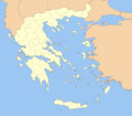
File:Greece prefectures map.png
Appearance

Size of this preview: 685 × 599 pixels. Other resolutions: 274 × 240 pixels | 549 × 480 pixels.
Original file (800 × 700 pixels, file size: 17 KB, MIME type: image/png)
File history
Click on a date/time to view the file as it appeared at that time.
| Date/Time | Thumbnail | Dimensions | User | Comment | |
|---|---|---|---|---|---|
| current | 10:17, 31 August 2008 |  | 800 × 700 (17 KB) | Geraki | added missing boundary |
| 12:12, 11 February 2007 |  | 800 × 700 (17 KB) | ChrisO | Outline map of the prefectures of Greece. Adapted from Image:Greece outline map.png Category:Maps of Greece |
File usage
The following page uses this file:
Global file usage
The following other wikis use this file:
- Usage on el.wikipedia.org
- Usage on fr.wikipedia.org
