
File:Gulf of Boothia, map drawn by Inuit 1829.jpg

Size of this preview: 733 × 599 pixels. Other resolutions: 294 × 240 pixels | 587 × 480 pixels | 940 × 768 pixels | 1,052 × 860 pixels.
Original file (1,052 × 860 pixels, file size: 138 KB, MIME type: image/jpeg)
| This is a file from the Wikimedia Commons. Information from its description page there is shown below. Commons is a freely licensed media file repository. You can help. |
Summary
| Description |
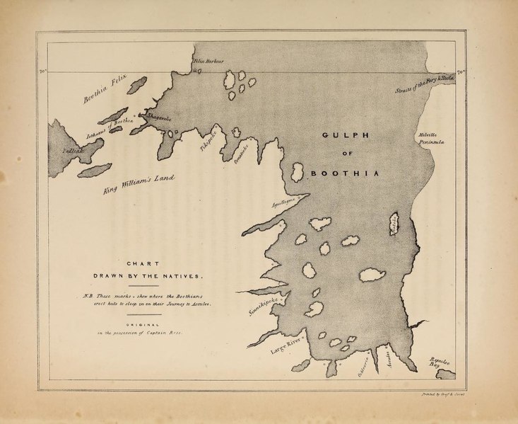
English: Gulf of Boothia, map drawn by Inuit 1829 |
| Date | |
| Source | Narrative of a second voyage in search of a north-west passage, and of a residence in the Arctic regions during the years 1829, 1830, 1831, 1832, 1833. London, A.W. Webster. |
| Author | Ross, John (24 June 1777 – 30 August 1856) , Ross, James Clark. (15 April 1800 – 3 April 1862) |
| Other versions |
.jpg)
Licensing
|
This work is in the public domain in its country of origin and other countries and areas where the copyright term is the author's life plus 70 years or fewer. This work is in the public domain in the United States because it was published (or registered with the U.S. Copyright Office) before January 1, 1929. | |
| This file has been identified as being free of known restrictions under copyright law, including all related and neighboring rights. | |
File history
Click on a date/time to view the file as it appeared at that time.
| Date/Time | Thumbnail | Dimensions | User | Comment | |
|---|---|---|---|---|---|
| current | 13:07, 4 August 2017 | | 1,052 × 860 (138 KB) | Thincat | rotated |
| 13:02, 4 August 2017 |  | 860 × 1,052 (121 KB) | Thincat | User created page with UploadWizard |
File usage
No pages on the English Wikipedia use this file (pages on other projects are not listed).