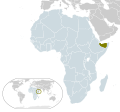
File:Location Somaliland AU Africa.svg
Appearance

Size of this PNG preview of this SVG file: 646 × 600 pixels. Other resolutions: 258 × 240 pixels | 517 × 480 pixels | 827 × 768 pixels | 1,103 × 1,024 pixels | 2,206 × 2,048 pixels | 1,400 × 1,300 pixels.
Original file (SVG file, nominally 1,400 × 1,300 pixels, file size: 2.29 MB)
File history
Click on a date/time to view the file as it appeared at that time.
| Date/Time | Thumbnail | Dimensions | User | Comment | |
|---|---|---|---|---|---|
| current | 09:59, 4 November 2023 |  | 1,400 × 1,300 (2.29 MB) | Siirski | Reverted to version as of 21:23, 11 November 2021 (UTC) |
| 01:13, 2 October 2023 |  | 1,400 × 1,300 (2.3 MB) | Caawiyahaderon | https://www.thehindu.com/news/international/pro-somalia-militia-takes-key-army-base-in-breakaway-region/article67238670.ece | |
| 21:23, 11 November 2021 |  | 1,400 × 1,300 (2.29 MB) | Gebagebo | Adjusted border | |
| 21:28, 20 August 2020 |  | 1,400 × 1,300 (2.18 MB) | Hogweard | South Sudan border | |
| 05:35, 17 February 2017 |  | 1,400 × 1,300 (2.17 MB) | Chipmunkdavis | Updating Morocco, matching minimap colour to main map colour | |
| 12:04, 30 July 2009 |  | 1,400 × 1,300 (2.17 MB) | Alvaro1984 18 | {{Information |Description={{en|1=Map of Somaliland}} {{es|1=Mapa de Somalilandia}} |Source=trabajo propio (own work) |Author=Alvaro1984 18 |Date=30/07/2009 |Permission= |other_versions= }} Category:Location maps of Africa [[Ca |
File usage
The following page uses this file:
Global file usage
The following other wikis use this file:
- Usage on anp.wikipedia.org
- Usage on az.wikipedia.org
- Usage on dag.wikipedia.org
- Usage on fr.wikipedia.org
- Usage on ha.wikipedia.org
- Usage on hu.wikipedia.org
- Usage on ilo.wikipedia.org
- Usage on incubator.wikimedia.org
- Usage on ja.wikipedia.org
- Usage on km.wikipedia.org
- Usage on my.wikipedia.org
- Usage on pnb.wikipedia.org
- Usage on si.wikipedia.org
- Usage on sr.wikipedia.org
- Usage on th.wikipedia.org
- Usage on ur.wikipedia.org
- Usage on zh.wikipedia.org
