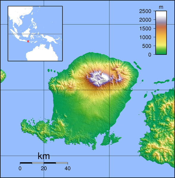
File:Lombok Locator Topography.png
Appearance

Size of this preview: 589 × 599 pixels. Other resolutions: 236 × 240 pixels | 472 × 480 pixels | 755 × 768 pixels | 1,007 × 1,024 pixels | 2,003 × 2,037 pixels.
Original file (2,003 × 2,037 pixels, file size: 1.93 MB, MIME type: image/png)
File history
Click on a date/time to view the file as it appeared at that time.
| Date/Time | Thumbnail | Dimensions | User | Comment | |
|---|---|---|---|---|---|
| current | 06:28, 12 February 2010 |  | 2,003 × 2,037 (1.93 MB) | Elekhh | {{Information |Description=Topographic map of Lombok, Indonesia. Created with GMT from SRTM data |Source=*File:Lombok_Topography.png |Date=2010-02-12 06:26 (UTC) |Author=*File:Lombok_Topography.png: Sadalmelik *derivative w |
File usage
The following 29 pages use this file:
- 5 August 2018 Lombok earthquake
- Babak River
- Bayan, Bayan, North Lombok
- Belanting
- Central Lombok Regency
- Dodokan River
- East Lombok Regency
- Gerung
- Jangkok River
- Kuta, Lombok
- Labuhan Lombok
- List of national parks of Indonesia
- Lombok International Airport
- Mandalika (resort area)
- Mataram (city)
- Mount Rinjani
- Mount Rinjani National Park
- North Lombok Regency
- Pengenjek
- Praya, Lombok
- Selaparang Airport
- Selong
- Senggigi
- Tanak Tepong
- Tanjung, Lombok
- West Lombok Regency
- User:Ty654/List of earthquakes from 2015-2019 exceeding magnitude 6+
- Module:Location map/data/Indonesia Lombok
- Module:Location map/data/Indonesia Lombok/doc
Global file usage
The following other wikis use this file:
- Usage on ar.wikipedia.org
- Usage on ban.wikipedia.org
- Usage on ceb.wikipedia.org
- Usage on de.wikipedia.org
- Usage on fa.wikipedia.org
- Usage on fr.wikipedia.org
- Usage on hu.wikipedia.org
- Usage on id.wikipedia.org
- Usage on ja.wikipedia.org
- Usage on kn.wikipedia.org
- Usage on ko.wikipedia.org
- Usage on ml.wikipedia.org
- Usage on nl.wikipedia.org
View more global usage of this file.

