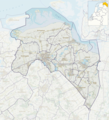
File:P01-GR-positiekaart2-gemlabels.png
Appearance

Size of this preview: 545 × 599 pixels. Other resolutions: 218 × 240 pixels | 437 × 480 pixels | 699 × 768 pixels | 1,061 × 1,166 pixels.
Original file (1,061 × 1,166 pixels, file size: 811 KB, MIME type: image/png)
File history
Click on a date/time to view the file as it appeared at that time.
| Date/Time | Thumbnail | Dimensions | User | Comment | |
|---|---|---|---|---|---|
| current | 15:58, 19 June 2021 |  | 1,061 × 1,166 (811 KB) | Janwillemvanaalst | Map layers update: municipal changes processed |
| 16:51, 1 January 2017 |  | 1,061 × 1,166 (671 KB) | Janwillemvanaalst | Map layers update as of 2017, including new municipal borders | |
| 11:16, 17 January 2016 |  | 1,061 × 1,166 (654 KB) | Janwillemvanaalst | Added NL index frame | |
| 20:10, 11 January 2016 |  | 1,061 × 1,166 (651 KB) | Janwillemvanaalst | User created page with UploadWizard |
File usage
The following page uses this file:
Global file usage
The following other wikis use this file:
- Usage on af.wikipedia.org
- Usage on da.wikipedia.org
- Usage on de.wikipedia.org
- Usage on eo.wikipedia.org
- Usage on es.wikipedia.org
- Usage on frr.wikipedia.org
- Usage on fy.wikipedia.org
- Grinslân
- Grins (stêd)
- De Grinzer Pein
- De Wylp
- Mearum
- Wynskoat
- De Like
- Lauwerseach
- Westeremden
- Sebaldebuorren
- Grypskerk
- Ezinge
- Oldehove
- Feerwerd
- Garnwerd
- Aduard
- Midwolde
- Tolbert
- Lytsegast
- Doezum
- Koerherne
- Heveskes
- Termunterzijl
- Fisfliet
- Trimunt
- Baflo
- Niebert
- Noardhorn
- Briltil
- Pitersyl
- Lettelbert
- Midwolda
- Wehe-den Hoorn
- Saaksum
View more global usage of this file.
