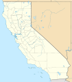
File:Relief map of Northern California.png
Appearance
Relief_map_of_Northern_California.png (654 × 489 pixels, file size: 454 KB, MIME type: image/png)
File history
Click on a date/time to view the file as it appeared at that time.
| Date/Time | Thumbnail | Dimensions | User | Comment | |
|---|---|---|---|---|---|
| current | 18:09, 23 June 2019 |  | 654 × 489 (454 KB) | RaviC | File:Relief map of California.png cropped 4 % horizontally, 37 % vertically using CropTool with precise mode. |
File usage
The following 15 pages use this file:
- Anthony Peak
- Atherwood
- City of Ten Thousand Buddhas
- Fort Bragg, California
- Foster City, California
- Mount Saint Helena
- Patchen Pass
- Sausalito, California
- The Inkwells
- Three Rivers, California
- Yolo Bypass
- User:RogueScholar/sandbox 1
- Wikipedia:Graphics Lab/Map workshop/Archive/Jun 2019
- Module:Location map/data/USA California Northern
- Module:Location map/data/USA California Northern/doc
Global file usage
The following other wikis use this file:
- Usage on azb.wikipedia.org
- Usage on fr.wikipedia.org
- Usage on hi.wikipedia.org
- Usage on ja.wikipedia.org
- Usage on ml.wikipedia.org
- Usage on ru.wikipedia.org
- Usage on simple.wikipedia.org
- Usage on si.wikipedia.org
- Usage on uz.wikipedia.org


