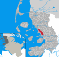
File:Reussenkoege in NF.PNG
Appearance
Reussenkoege_in_NF.PNG (353 × 340 pixels, file size: 8 KB, MIME type: image/png)
File history
Click on a date/time to view the file as it appeared at that time.
| Date/Time | Thumbnail | Dimensions | User | Comment | |
|---|---|---|---|---|---|
| current | 13:37, 9 October 2019 |  | 353 × 340 (8 KB) | NordNordWest | upd |
| 22:04, 1 August 2007 |  | 353 × 340 (15 KB) | Goegeo | == Beschreibung == * en: This map shows the area of the Gemeinde (municipality) Reußenköge in the Kreis (district) Nordfriesland, Schleswig-Holstein, Germany. * de: Diese Karte zeigt das Gebiet der Gemeinde [[:de:Reußenköge|Reuße | |
| 14:14, 21 January 2007 |  | 353 × 340 (7 KB) | ClausG | Corrections in Husum-Schobüll, Klanxbüll and Rodenäs, Reußenköge and Ockholm | |
| 15:50, 11 September 2006 |  | 353 × 340 (7 KB) | Raymond | improved version with corrected municipal area, see OTRS ticketno. 2006091110007614 | |
| 15:32, 6 September 2006 |  | 353 × 340 (7 KB) | ClausG | {{GFDL}} == Beschreibung == * en: This map shows the area of the Gemeinde (municipality) Reußenköge in the Kreis (district) Nordfriesland, Schleswig-Holstein, Germany. * de: Diese Karte zeigt das Gebiet der Gemeinde [[:de:Reußenk� |
File usage
The following page uses this file:
Global file usage
The following other wikis use this file:
- Usage on ca.wikipedia.org
- Usage on da.wikipedia.org
- Usage on de.wikipedia.org
- Usage on eo.wikipedia.org
- Usage on es.wikipedia.org
- Usage on eu.wikipedia.org
- Usage on frr.wikipedia.org
- Usage on fy.wikipedia.org
- Usage on hu.wikipedia.org
- Usage on it.wikipedia.org
- Usage on mk.wikipedia.org
- Usage on nl.wikipedia.org
- Usage on pl.wikipedia.org
- Usage on pt.wikipedia.org
- Usage on ro.wikipedia.org
- Usage on sh.wikipedia.org
- Usage on sr.wikipedia.org
- Usage on sv.wikipedia.org
- Usage on tr.wikipedia.org
- Usage on tt.wikipedia.org
- Usage on uk.wikipedia.org
- Usage on vi.wikipedia.org
- Usage on www.wikidata.org
- Usage on zh-min-nan.wikipedia.org

