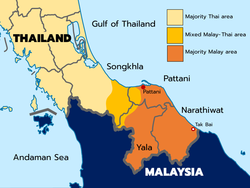
File:Souththailandmap.svg
Appearance

Size of this PNG preview of this SVG file: 800 × 600 pixels. Other resolutions: 320 × 240 pixels | 640 × 480 pixels | 1,024 × 768 pixels | 1,280 × 960 pixels | 2,560 × 1,920 pixels | 960 × 720 pixels.
Original file (SVG file, nominally 960 × 720 pixels, file size: 280 KB)
File history
Click on a date/time to view the file as it appeared at that time.
| Date/Time | Thumbnail | Dimensions | User | Comment | |
|---|---|---|---|---|---|
| current | 02:17, 1 November 2022 |  | 960 × 720 (280 KB) | Blackman Jr. | Reverted to version as of 02:16, 1 November 2022 (UTC) |
| 02:16, 1 November 2022 |  | 4,080 × 3,060 (119 KB) | Blackman Jr. | Reverted to version as of 02:15, 1 November 2022 (UTC) | |
| 02:16, 1 November 2022 |  | 960 × 720 (280 KB) | Blackman Jr. | Reverted to version as of 15:09, 30 March 2022 (UTC) | |
| 02:15, 1 November 2022 |  | 4,080 × 3,060 (119 KB) | Blackman Jr. | In the southern part of Satun there is a Malay minority mixed with Thai ethnicity | |
| 15:09, 30 March 2022 |  | 960 × 720 (280 KB) | ILikelargeFries | Minor changes | |
| 15:29, 12 January 2022 |  | 960 × 720 (273 KB) | ILikelargeFries | Removed river in Malaysia and minor islands | |
| 15:10, 12 January 2022 |  | 960 × 720 (279 KB) | ILikelargeFries | Uploaded own work with UploadWizard |
File usage
The following 5 pages use this file:
Global file usage
The following other wikis use this file:
- Usage on ca.wikipedia.org
- Usage on hu.wikipedia.org
- Usage on ms.wikipedia.org
- Usage on th.wikipedia.org
- Usage on www.wikidata.org
