
File:Wurrwurrwuy map, showing Australian National Heritage List boundaries, 9 August 2013.pdf

Size of this JPG preview of this PDF file: 800 × 566 pixels. Other resolutions: 320 × 226 pixels | 640 × 453 pixels | 1,024 × 724 pixels | 1,280 × 905 pixels | 1,752 × 1,239 pixels.
Original file (1,752 × 1,239 pixels, file size: 5.79 MB, MIME type: application/pdf)
| This is a file from the Wikimedia Commons. Information from its description page there is shown below. Commons is a freely licensed media file repository. You can help. |
Summary
| Description |
English: Wurrwurrwuy map, showing Australian National Heritage List boundaries, 9 August 2013 |
| Date | |
| Source | Wurrwurrwuy, National Heritage List , © Commonwealth of Australia 2018, published by the Department of the Environment and Energy under CC-BY-4.0 licence |
| Author | Environment Research Information Network |
Licensing
This file is licensed under the Creative Commons Attribution 4.0 International license.
- You are free:
- to share – to copy, distribute and transmit the work
- to remix – to adapt the work
- Under the following conditions:
- attribution – You must give appropriate credit, provide a link to the license, and indicate if changes were made. You may do so in any reasonable manner, but not in any way that suggests the licensor endorses you or your use.
File history
Click on a date/time to view the file as it appeared at that time.
| Date/Time | Thumbnail | Dimensions | User | Comment | |
|---|---|---|---|---|---|
| current | 07:12, 20 October 2018 | 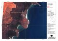 | 1,752 × 1,239 (5.79 MB) | Kerry Raymond | User created page with UploadWizard |
File usage
The following pages on the English Wikipedia use this file (pages on other projects are not listed):
Global file usage
The following other wikis use this file:
- Usage on www.wikidata.org