
Flat Top, Virginia
Flat Top is an unincorporated community in Dickenson County, Virginia, in the United States.[1]
History
Flat Top was so named from the presence of a flat pasture where cattle would graze.[2]
References
- ^ U.S. Geological Survey Geographic Names Information System: Flat Top, Virginia
- ^ Tennis, Joe (2004). Southwest Virginia Crossroads: An Almanac of Place Names and Places to See. The Overmountain Press. p. 10. ISBN 978-1-57072-256-1.
Municipalities and communities of Dickenson County, Virginia, United States | ||
|---|---|---|
| Towns | 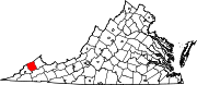 | |
| CDPs | ||
| Unincorporated communities | ||
| Footnotes | ‡This populated place also has portions in an adjacent county or counties | |
37°01′44″N 82°23′51″W / 37.02889°N 82.39750°W
This Dickenson County, Virginia state location article is a stub. You can help Wikipedia by expanding it. |