Fort Lytton Historic Military Precinct
This article needs more links to other articles to help integrate it into the encyclopedia. (October 2016) |
| Fort Lytton Historic Military Precinct Brisbane, Queensland | |
|---|---|
 Inside the colonial fort. | |
| Coordinates | 27°24′38″S 153°09′04″E / 27.41056°S 153.15111°E |
| Website | Fort Lytton Historic Military Precinct |
| Footnotes | Open free 10am-4pm most Sundays and public holidays. For access at other times, photo shoots and other special events phone national park office (07) 33934647. |
| See also | Protected areas of Queensland |
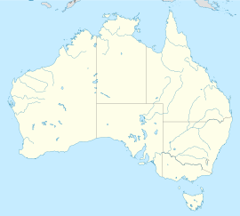
Fort Lytton Historic Military Precinct[1] is the main attraction of Fort Lytton National Park. It is open free from10am to 4pm on most Sundays and public holidays, and for special events.[2] It contains historic Fort Lytton (a colonial coastal defence fort), and numerous other historic military buildings and structures from colonial times to the Second World War. The precinct is at the epicentre of what was once a one square mile (259 ha) defence base[3] strategically located at the mouth of the Brisbane River (the base was also called “Fort Lytton”). In addition to historic buildings and structures, the precinct contains Fort Lytton Military Museum[4] and is the site of regular military re-enactments.[5] The national park is located in the Brisbane suburb of Lytton.
Gallery
-
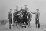
Submarine mining engineers at Fort Lytton c.1890.
-
100pdr Disappearing Gun in Firing Position at Fort Lytton c.1890.
-
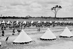
Mounted infantry encamped at Fort Lytton c1899.
-
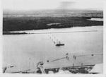
Anti-submarine barrier across Brisbane River at Fort Lytton 1943.
-
4.7inch gun emplacement at Fort Lytton 1943.
-
Armistice day service beside 155mm heavy gun at Fort Lytton 11 Nov 1943.
-
3.7inch heavy anti-aircraft gun at Fort Lytton 1943.
-
Bofors light anti-aircraft gun at Fort Lytton 1944.
Notes and References
- ^ See Fort Lytton Historic Military Precinct website
- ^ For specific opening dates, see Fort Lytton Historic Military Precinct | Coming Events
- ^ See Fort Lytton Historic Military Precinct | Lytton Defence Reserve
- ^ See Fort Lytton Historic Military Precinct | Fort Lytton Military Museum
- ^ See Fort Lytton Historic Military Precinct | Re-enactments


