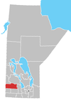
Franklin, Manitoba
Appearance
Franklin is a community in Rural Municipality of Rosedale in the province of Manitoba in Western Canada. It is west of Neepawa, Manitoba and was known as Bridge Creek, (or possibly Budge Creek), until 1890. It was then named Franklin and referred to a post office, a CPR midpoint and a school district so named. The origins of that name also are not clear, one source citing the U.S. President and another the explorer, Sir John Franklin.
The rural municipality of the same name lies in the southeast corner of Manitoba on the Minnesota border was definitely named for the explorer.
References
- Geographic Names of Manitoba (pg. 86) - the Millennium Bureau of Canada

