
Frederick E. Hyde Fjord
| Frederick E. Hyde Fjord | |
|---|---|
 Frederick E. Hyde Fjord Location in Greenland | |
| Location | Arctic |
| Coordinates | 83°04′N 31°15′W / 83.067°N 31.250°W |
| Ocean/sea sources | Wandel Sea, Arctic Ocean |
| Basin countries | Greenland |
| Max. length | 140 km (87 mi) |
| Max. width | 7 km (4.3 mi) |
Frederick E. Hyde Fjord is a fjord in Peary Land, far northern Greenland.
Geography
To the east Frederick E. Hyde Fjord opens into the Arctic Ocean with its mouth just to the north of Cape John Flagler.[1]
Freja Fjord, Thor Fjord and Odin Fjord are branches on the southern shore of the fjord, about 65, 95 and 120 km from the mouth respectively; Frigg Fjord is an offshoot on the northern shore located 95 km from the mouth.[2]
The 1,220 m high Nordkronen plateau is located on the southern side of Frederick E. Hyde Fjord. The Nordkronen has many glaciers and is intersected by deep ravines with steep sides. 1,737 m high Wistar Bjerg, one of the highest points in Peary Land, rises above the fjord between the Freya and Thor fjords at the edge of the plateau.[3]
-
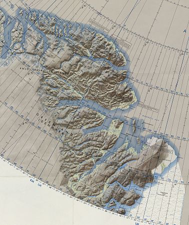 Map of Far Northeastern Greenland
 -
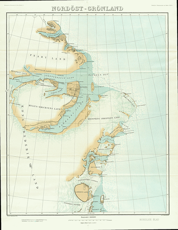 1911 map of NE Greenland showing only a short stretch of the Frederick E. Hyde Fjord


See also
References
- ^ "Frederick E. Hyde Fjord". Mapcarta. Retrieved 5 May 2016.
- ^ Prostar Sailing Directions 2005 Greenland and Iceland Enroute, p. 130
- ^ Den grønlandske Lods - Geodatastyrelsen
External links
This Greenland location article is a stub. You can help Wikipedia by expanding it. |