
Gäufelden
You can help expand this article with text translated from the corresponding article in German. (February 2009) Click [show] for important translation instructions.
|
Gäufelden | |
|---|---|
 Coat of arms | |
Location of Gäufelden within Böblingen district 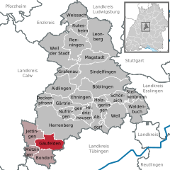 | |
 Gäufelden  Gäufelden | |
| Coordinates: 48°33′10″N 8°49′9″E / 48.55278°N 8.81917°E | |
| Country | Germany |
| State | Baden-Württemberg |
| Admin. region | Stuttgart |
| District | Böblingen |
| Subdivisions | 3 |
| Government | |
| • Mayor | Johannes Buchter |
| Area | |
| • Total | 20.07 km2 (7.75 sq mi) |
| Elevation | 481 m (1,578 ft) |
| Population (2022-12-31)[1] | |
| • Total | 9,241 |
| • Density | 460/km2 (1,200/sq mi) |
| Time zone | UTC+01:00 (CET) |
| • Summer (DST) | UTC+02:00 (CEST) |
| Postal codes | 71126 |
| Dialling codes | 07032 |
| Vehicle registration | BB |
| Website | www.gaeufelden.de |
Gäufelden is a municipality in the administrative district of Böblingen, in the German state of Baden-Württemberg.
Geography
Gäufelden is located in the upper Gäu, 7 km from Herrenberg and 7 km from Nagold .
History
The municipality was founded July 1, 1971 by the voluntary merger of the previously independent villages of Nebringen, Öschelbronn and Tailfingen. Since then, the population has more than doubled. These three villages constitute "Ortsteile" (districts) of Gäufelden. Each district retains a Rathaus (town hall), but the administration is centralized in Öschelbronn.
Former mayors
- Herrmann Wolf (1971-2003)
References
- ^ "Bevölkerung nach Nationalität und Geschlecht am 31. Dezember 2022" [Population by nationality and sex as of December 31, 2022] (CSV) (in German). Statistisches Landesamt Baden-Württemberg. June 2023.
External links
Towns and municipalities in Böblingen (district) | ||
|---|---|---|
| International | |
|---|---|
| National | |
This Böblingen district location article is a stub. You can help Wikipedia by expanding it. |