
Glenwood, Klickitat County, Washington
Glenwood, Washington | |
|---|---|
| Country | United States |
| State | Washington |
| County | Klickitat |
| Elevation | 1,900 ft (600 m) |
| Time zone | UTC-8 (Pacific (PST)) |
| • Summer (DST) | UTC-7 (PDT) |
| ZIP code | 98619 |
| Area code | 509 |
| GNIS feature ID | 1520005[1] |
Glenwood is an unincorporated community in Klickitat County, Washington, United States. Glenwood is 26.5 miles (42.6 km) west-northwest of Goldendale. Glenwood has a post office with ZIP code 98619.[2] The community is on land whose jurisdiction is disputed between the Yakama Nation and Klickitat County.[3]
The community was named for the glen and woods near the original town site.[4]
Climate
Glenwood has a warm-summer Mediterranean climate (Csb) according to the Köppen climate classification system.
| Climate data for Glenwood, elev. 1,900 feet (579 m) | |||||||||||||
|---|---|---|---|---|---|---|---|---|---|---|---|---|---|
| Month | Jan | Feb | Mar | Apr | May | Jun | Jul | Aug | Sep | Oct | Nov | Dec | Year |
| Record high °F (°C) | 59 (15) |
68 (20) |
74 (23) |
85 (29) |
97 (36) |
98 (37) |
101 (38) |
100 (38) |
99 (37) |
87 (31) |
70 (21) |
57 (14) |
101 (38) |
| Mean daily maximum °F (°C) | 38.4 (3.6) |
42.9 (6.1) |
50.3 (10.2) |
57 (14) |
65.4 (18.6) |
71.5 (21.9) |
80 (27) |
81.1 (27.3) |
73.7 (23.2) |
60.9 (16.1) |
46 (8) |
36.9 (2.7) |
58.7 (14.8) |
| Mean daily minimum °F (°C) | 23.5 (−4.7) |
24.5 (−4.2) |
28.2 (−2.1) |
30.2 (−1.0) |
34.8 (1.6) |
39.9 (4.4) |
42.9 (6.1) |
42.1 (5.6) |
35 (2) |
29.2 (−1.6) |
27.4 (−2.6) |
22.7 (−5.2) |
31.7 (−0.2) |
| Record low °F (°C) | −24 (−31) |
−18 (−28) |
3 (−16) |
11 (−12) |
14 (−10) |
22 (−6) |
28 (−2) |
25 (−4) |
16 (−9) |
−1 (−18) |
−22 (−30) |
−27 (−33) |
−27 (−33) |
| Average precipitation inches (mm) | 5.41 (137) |
3.85 (98) |
3 (76) |
1.55 (39) |
1.09 (28) |
0.77 (20) |
0.22 (5.6) |
0.25 (6.4) |
0.8 (20) |
2.01 (51) |
4.97 (126) |
5.99 (152) |
29.91 (760) |
| Average snowfall inches (cm) | 18.5 (47) |
9.5 (24) |
5.2 (13) |
0.4 (1.0) |
0 (0) |
0 (0) |
0 (0) |
0 (0) |
0 (0) |
0.2 (0.51) |
6.7 (17) |
20.5 (52) |
60.9 (155) |
| Average precipitation days | 13 | 10 | 11 | 8 | 5 | 4 | 2 | 1 | 4 | 7 | 13 | 13 | 91 |
| Source: Western Regional Climate Center (1979-2014) [5] | |||||||||||||
Land dispute
Ownership of this area has been in dispute dating back to the Treaty of 1855. An 1890 survey of the Yakama Reservation, accepted by the General Land Office, did not include the area known as "Tract-D". The original treaty map, which included the Tract-D area, was found in 1930 after being misplaced for decades. In the meantime 98,000 acres of the Glenwood Valley had passed into private ownership. Another 21,000 acres were part of the Gifford Pinchot National Forest administered by the United States Department of Agriculture. After more than 100 years of dispute, in 1972 President Richard Nixon by Executive Order 11670 authorized the return of the 21,000 acre portion of Mt. Adams, including the Summit, to the Yakama Nation. Area returned to the Yakama Nation did not include the 98,000 acres of Tract D in the Glenwood Valley.[6] The Yakama Nation accepted $2.1 million in 1970 for their claims.[7]
References
Glenwood Washington Weather and Community Information http://www.glenwoodwashingtonweather.info/ http://www.goldendalesentinel.com/story/2015/04/29/news/glenwood-fights-to-avoid-being-absorbed-into-indian-lands/5805.html http://www.wsdot.wa.gov/mapsdata/geodatacatalog/Maps/noscale/DOT_Cartog/TribalLands.htm
- ^ U.S. Geological Survey Geographic Names Information System: Glenwood, Klickitat County, Washington
- ^ ZIP Code Lookup
- ^ [1]
- ^ Meany, Edmond S. (1923). Origin of Washington geographic names. Seattle: University of Washington Press. p. 98.
{{cite book}}: Cite has empty unknown parameter:|1=(help) - ^ "Glenwood #2, WASHINGTON (453184)". Western Regional Climate Center. Retrieved November 16, 2015.
- ^ [2]
- ^ [3]
Municipalities and communities of Klickitat County, Washington, United States | ||
|---|---|---|
| Cities | 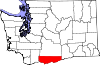 | |
| CDPs | ||
| Unincorporated communities | ||
| Ghost towns | ||
| Indian reservation | ||
| Footnotes | ‡This populated place also has portions in an adjacent county or counties | |
This Klickitat County, Washington state location article is a stub. You can help Wikipedia by expanding it. |