
Grebenstein
Grebenstein | |
|---|---|
 Coat of arms | |
Location of Grebenstein within Kassel district 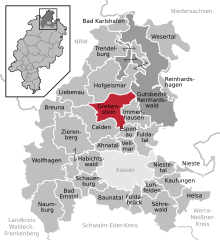 | |
| Country | Germany |
| State | Hesse |
| Admin. region | Kassel |
| District | Kassel |
| Government | |
| • Mayor | Armin Kölling |
| Area | |
| • Total | 49.85 km2 (19.25 sq mi) |
| Elevation | 249 m (817 ft) |
| Population (2022-12-31)[1] | |
| • Total | 5,790 |
| • Density | 120/km2 (300/sq mi) |
| Time zone | UTC+01:00 (CET) |
| • Summer (DST) | UTC+02:00 (CEST) |
| Postal codes | 34393 |
| Dialling codes | 05674 |
| Vehicle registration | KS or HOG |
| Website | www.stadt-grebenstein.de |


Grebenstein is a town in the district of Kassel, in Hesse, Germany. It is located 16 km northwest of Kassel on the German Timber-Frame Road. In 1762 it was the scene of a skirmish between British and French troops during the Seven Years' War.
References
- ^ "Bevölkerung in Hessen am 31.12.2022 nach Gemeinden" (XLS) (in German). Hessisches Statistisches Landesamt. June 2023.
External links
Wikimedia Commons has media related to Grebenstein, Germany.
Towns and municipalities in Kassel district | ||
|---|---|---|
 | ||
| International | |
|---|---|
| National | |
| Geographic | |
This Hesse location article is a stub. You can help Wikipedia by expanding it. |