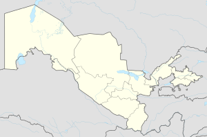
Guliston
Appearance
Guliston
Guliston / Гулистoн | |
|---|---|
 | |
| Coordinates: 40°29′N 68°47′E / 40.483°N 68.783°E | |
| Country | |
| Region | Sirdaryo Region |
| Established | 1801 |
| Elevation | 271 m (889 ft) |
| Population (2014) | |
| • Total | 77,300 |
| Postal code | 120100 |
| Area code | (+998) 672 |
Guliston also spelled as Gulistan (Template:Lang-uz; Template:Lang-ru), formerly known as Mirzachul (Russian: Мирзачуль, until 1961), is the capital of Sirdaryo Region in eastern Uzbekistan. It lies in the southeastern part of the Mirzachül (formerly Golodnaya) steppe, 75 miles (120 km) southwest of Tashkent. It has an approx. population of 77,300. The main industry in the area is cottonpicking.
Demographics
Population in:
- 1989: 54,400
- 1991: 54,500
- 2010 (estimate): 77,300
Source: [1]
References
Guliston. (2007). In Encyclopædia Britannica. Retrieved September 28, 2007, from Encyclopædia Britannica Online: http://www.britannica.com/eb/article-9038486


