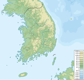
Gyeryongsan (South Gyeongsang Province)
| Gyeryongsan | |
|---|---|
| Korean name | |
| Hangul | |
| Hanja | |
| Revised Romanization | Gyeryongsan |
| McCune–Reischauer | Kyeryongsan |
| Highest point | |
| Elevation | 566 m (1,857 ft) |
| Coordinates | 34°52′17″N 128°36′29″E / 34.8713°N 128.608°E |
| Geography | |
| Location | Geoje, South Korea |
Gyeryongsan is a mountain located in Geoje, South Gyeongsang Province, South Korea. It has an elevation of 566 m (1,857 ft).[1]
See also
- Geography of Korea
- List of mountains in Korea
- List of mountains by elevation
- Mountain portal
- South Korea portal
References

