Hales, Staffordshire
Appearance
| Hales | |
|---|---|
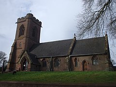
 St Mary's Church, Hales | |
Location within Staffordshire | |
| OS grid reference | SJ712340 |
| Civil parish | |
| Shire county | |
| Region | |
| Country | England |
| Sovereign state | United Kingdom |
| Post town | Market Drayton |
| Postcode district | TF9 |
| Police | Staffordshire |
| Fire | Staffordshire |
| Ambulance | West Midlands |
Hales is a village in Staffordshire approximately 2 miles east of Market Drayton. Population details as taken at the 2011 census can be found under Loggerheads. There is an Anglican church dedicated to Saint Mary.[1]

