
Hamlin, West Virginia
Hamlin, West Virginia | |
|---|---|
 Walnut Street (West Virginia Route 3) in Hamlin in 2007 | |
 Location of Hamlin, West Virginia | |
| Country | United States |
| State | West Virginia |
| County | Lincoln |
| Area | |
| • Total | 0.60 sq mi (1.55 km2) |
| • Land | 0.60 sq mi (1.55 km2) |
| • Water | 0 sq mi (0 km2) |
| Elevation | 653 ft (199 m) |
| Population | |
| • Total | 1,142 |
| • Estimate (2011[3]) | 1,134 |
| • Density | 1,903.3/sq mi (734.9/km2) |
| Time zone | UTC-5 (Eastern (EST)) |
| • Summer (DST) | UTC-4 (EDT) |
| ZIP code | 25523 |
| Area code | 304 |
| FIPS code | 54-34516Template:GR |
| GNIS feature ID | 1539881Template:GR |
Hamlin, originally named "Hamline," is a town in Lincoln County, West Virginia, United States, along the Mud River. The population was recorded as 1,142 at the 2010 census. It is the county seat of Lincoln County.Template:GR Hamlin is a part of the Huntington-Ashland, WV-KY-OH, Metropolitan Statistical Area (MSA). As of the 2010 census, the MSA had a population of 287,702. New definitions from February 28, 2013 placed the population at 363,000.[4]
History
The town was founded in 1835, and incorporated in 1867. Hamlin was named for either Bishop Leonidas Lent Hamline of the Methodist Church or President Abraham Lincoln's first Vice President, Hannibal Hamlin. A former postmaster claimed that Bishop Hamline added the "E" to his last name.[5]
Government
Hamlin is governed by a five council members and a mayor and recorder. Mayor Chris Wilkinson, Recorder Elizabeth Rexroad, Council members: Roy Lambert, Kenny Lambert, Daniel McKay, Olive Hager, and Rick Walls. Elections took place on June 8, 2010. The mayor, recorder and council members are elected to four-year terms.
Geography
Hamlin is located at 38°16′44″N 82°6′25″W / 38.27889°N 82.10694°W (38.278946, -82.106825).
According to the United States Census Bureau, the town has a total area of 0.60 square miles (1.55 km2), all of it land.[1]
Demographics
2010 census
As of the census[2] of 2010, there were 1,142 people, 467 households, and 311 families residing in the town. The population density was 1,903.3 inhabitants per square mile (734.9/km2). There were 528 housing units at an average density of 880.0 per square mile (339.8/km2). The racial makeup of the town was 99.0% White, 0.1% Native American, 0.1% Asian, and 0.8% from two or more races. Hispanic or Latino of any race were 0.9% of the population.
There were 467 households out of which 29.3% had children under the age of 18 living with them, 43.5% were married couples living together, 16.7% had a female householder with no husband present, 6.4% had a male householder with no wife present, and 33.4% were non-families. 30.6% of all households were made up of individuals and 12.8% had someone living alone who was 65 years of age or older. The average household size was 2.32 and the average family size was 2.82.
The median age in the town was 43.2 years. 19.7% of residents were under the age of 18; 9.3% were between the ages of 18 and 24; 23% were from 25 to 44; 26.1% were from 45 to 64; and 21.9% were 65 years of age or older. The gender makeup of the town was 46.2% male and 53.8% female.
2000 census
As of the censusTemplate:GR of 2000, there were 1,119 people, 478 households, and 312 families residing in the town. The population density was 1,949.7 inhabitants per square mile (758.0/km²). There were 527 housing units at an average density of 918.2 per square mile (357.0/km²). The racial makeup of the town was 98.84% White, 0.09% African American, 0.27% Native American, and 0.80% from two or more races. Hispanic or Latino of any race were 0.54% of the population.

There were 478 households out of which 29.3% had children under the age of 18 living with them, 43.9% were married couples living together, 17.6% had a female householder with no husband present, and 34.7% were non-families. 32.4% of all households were made up of individuals and 15.7% had someone living alone who was 65 years of age or older. The average household size was 2.21 and the average family size was 2.77.
In the town the population was spread out with 21.0% under the age of 18, 9.1% from 18 to 24, 26.9% from 25 to 44, 21.2% from 45 to 64, and 21.8% who were 65 years of age or older. The median age was 41 years. For every 100 females there were 80.2 males. For every 100 females age 18 and over, there were 73.7 males.
The median income for a household in the town was $22,143, and the median income for a family was $30,250. Males had a median income of $30,000 versus $17,059 for females. The per capita income for the town was $13,728. About 20.3% of families and 22.6% of the population were below the poverty line, including 38.0% of those under age 18 and 12.1% of those age 65 or over.
Notable residents
- Chuck Yeager, aviator (b. 1923)
- J. S. Pridemore, Oil Industrialist
References
- ^ a b "US Gazetteer files 2010". United States Census Bureau. Retrieved 2013-01-24.
{{cite web}}: External link in|publisher= - ^ a b "American FactFinder". United States Census Bureau. Retrieved 2013-01-24.
{{cite web}}: External link in|publisher= - ^ "Population Estimates". United States Census Bureau. Retrieved 2013-01-24.
{{cite web}}: External link in|publisher= - ^ "Population statistics" (PDF).
- ^ http://www.lincolncountywv.org/History/tabid/102/Default.aspx
Municipalities and communities of Lincoln County, West Virginia, United States | ||
|---|---|---|
| Towns | 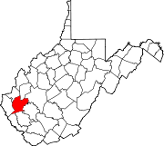 | |
| CDPs | ||
| Unincorporated communities |
| |
| Footnotes | ‡This populated place also has portions in an adjacent county or counties | |