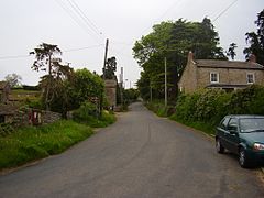
East Hauxwell
Appearance
| Hauxwell | |
|---|---|
 Hauxwell | |
Location within North Yorkshire | |
| Population | 111 (Including Barden and West Hauxwell.2011)[1] |
| OS grid reference | SE174931 |
| District | |
| Shire county | |
| Region | |
| Country | England |
| Sovereign state | United Kingdom |
| Post town | Leyburn |
| Postcode district | DL8 5 |
| Police | North Yorkshire |
| Fire | North Yorkshire |
| Ambulance | Yorkshire |
Hauxwell or East Hauxwell is a village and civil parish in the Richmondshire district of North Yorkshire, England. It is located south of Catterick Garrison.[2]
To the west of the village lies Hauxwell Hall, a 17th-century country house belonging to the Dalton family.

Notable people
- Sir Richard Dalton
- Mark Pattison
- Dorothy Wyndlow Pattison ("Sister Dora")
References
- ^ "Civil Parish population 2011". Neighbourhood Statistics. Office for National Statistics. Retrieved 8 August 2015.
- ^ Ordnance Survey: Landranger map sheet 99 Northallerton & Ripon (Pateley Bridge & Leyburn) (Map). Ordnance Survey. 2013. ISBN 9780319231593.
External links
![]() Media related to East Hauxwell at Wikimedia Commons
Media related to East Hauxwell at Wikimedia Commons

