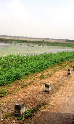
Heggadadevanakote
Heggadadevana kote
H.D Kote | |
|---|---|
city | |
 Mysore road from H.D.Kote | |
 | |
| Coordinates: 12°05′17″N 76°19′41″E / 12.088°N 76.328°E | |
| Country | |
| State | Karnataka |
| District | Mysore |
| Elevation | 694 m (2,277 ft) |
| Population (2001) | |
• Total | 12,043 |
| Languages | |
| • Official | Kannada |
| Time zone | UTC+5:30 (IST) |
| PIN | 571 114 |
| Telephone code | 08228 |
| Vehicle registration | KA-45 |
| Website | [<span%20class="url"> |

Heggadadevana kote or H.D.Kote is a taluk or taluk headquarters in Mysore district in the Indian state of Karnataka. Kakana kote forest lies in Heggadadevana kote taluk.
Demographics
As of 2001[update] India census,[1] Heggadadevanakote had a population of 12,043. Males constitute 51% of the population and females 49%. Heggadadevanakote has an average literacy rate of 66%, higher than the national average of 59.5%: male literacy is 72%, and female literacy is 60%. In Heggadadevanakote, 12% of the population is under 6 years of age.
Agriculture
H D Kote has four reservoirs: the Kabini, Nugu, Hebbala and Taraka reservoirs. Ironically, however, agriculture in this taluk is rain-fed mainly because the government has failed to harness the capacity of the reservoirs. Barring the Kabini reservoir, the other reservoirs are always dry. As a result, farmers who could otherwise raise three crops are able to hardly raise one and are perennially in debt. This is one of the main reasons[citation needed] for the economic backwardness of the taluk and distress migration to cities is common.
Taraka Lift Irrigation Project
The Taraka Lift Irrigation Project[2][3] was envisaged with a view to alleviating the miseries of the farmers of this taluk. The project entails pumping water 6 km from the Kabini reservoir into the Taraka reservoir; it was completed in 1983. Cauvery Neeravari Nigam Limited is in charge of this project and claims that 80% of the project is complete. The lift irrigation project was expected to be completed by January 2007.
The Taraka reservoir was in the news in October 2006 as one of the crest gates of the reservoirs breached leading to a major flooding of the villages downstream. This resulted in a major loss of animal life, agricultural produce and property though no human lives were lost.
Handpost Junction
Handpost Junction or Yerahalli is an important road junction of Heggadevana Kote connecting Mysore and Kerala state. This is a separate township attached to H.D.Kote main town.
Image Gallery
-
Boppanahalli village
-
Krishnaraja village
See also
References
- ^ "Census of India 2001: Data from the 2001 Census, including cities, villages and towns (Provisional)". Census Commission of India. Archived from the original on 16 June 2004. Retrieved 1 November 2008.
- ^ Doubts raised on Taraka lift irrigation project, The Hindu, 9 October 2006
- ^ Chief Minister draws flak for not visiting H.D. Kote, The Hindu, 8 October 2006


