
Henrico, Virginia
Henrico, Virginia is a location in Henrico County, Virginia that appears in Google maps. It is the name used by the U.S. Postal Service for several Zip code areas in unincorporated parts of Henrico County, surrounding the city of Richmond.[1]
Henrico is identified in the National Register of Historic Places's NRIS database as being the location of, or nearest community to, the Curles Neck Farm.[2][3]
There is a historic village of Henricus, Virginia, also known as "Henrico Town", which is different, as it is located in nearby Chesterfield County, Virginia.
References
- ^ "Look Up a ZIP Code". U.S. Postal Service. Retrieved October 1, 2011.
- ^ "National Register Information System". National Register of Historic Places. National Park Service. March 13, 2009.
- ^ Note, however, the NRIS identification of location for another place identified in NRIS as being in or near Henrico, Emmanuel Church at Brook Hill, seems to have been a typo; the full NRHP application for this other place shows it is just a place in Henrico County, and is not located in or near a community of Henrico.
Municipalities and communities of Henrico County, Virginia, United States | ||
|---|---|---|
| CDPs | 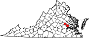 | |
| Unincorporated communities | ||