
Hicks Island
 | |
| Geography | |
|---|---|
| Location | Northern Australia |
| Coordinates | 11°58′59″S 143°16′08″E / 11.983°S 143.269°E |
| Administration | |
Hicks Island is an island about 1 km southeast of Cape Grenville in the Great Barrier Reef Marine Park Queensland, Australia, in Temple Bay about 200 km northeast of Iron Range National Park and Lockhart River in the Cape York Peninsula.[1] It is around 160 hectares (395.4 acres) in size.[1] This island is part of the Home Islands Group.
Birdlife
Hicks Island is also part of the Cape York to Cape Grenville Islands Important Bird Area.[2] The island is inhabited by species such as the pied imperial-pigeon, bridled tern, roseate tern and lesser crested tern.
-
 A pied imperial-pigeon
 -
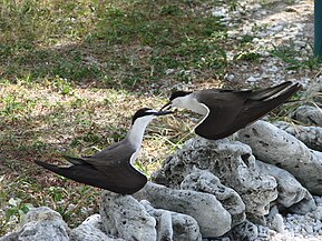 A bridled tern pair
 -
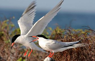 A roseate tern pair


References
- ^ a b "Map of Hicks Island,QLD". Retrieved 10 January 2013.
- ^ "Cape York to Cape Grenville Islands". BirdLife International. Retrieved 10 January 2013.
This Queensland protected areas related article is a stub. You can help Wikipedia by expanding it. |