
Hobart Bay, Alaska
Hobart Bay, Alaska | |
|---|---|
 Moonrise on Hobart Bay | |
 Location of Hobart Bay, Alaska | |
| Country | United States |
| State | Alaska |
| Census Area | Hoonah-Angoon |
| Area | |
• Total | 129.8 sq mi (336.2 km2) |
| • Land | 117.4 sq mi (304.1 km2) |
| • Water | 12.4 sq mi (32.1 km2) |
| Elevation | 1,184 ft (361 m) |
| Population (2000) | |
• Total | 1 |
| • Density | 0.0077/sq mi (0.0030/km2) |
| Time zone | UTC-9 (Alaska (AKST)) |
| • Summer (DST) | UTC-8 (AKDT) |
| Area code | 907 |
| FIPS code | 02-32550 |
| GNIS feature ID | 1866951 |
Hobart Bay is a census-designated place located in Hoonah-Angoon Census Area, Alaska. As of the 2010 Census, the population of the CDP was one.
The bay was named in 1889 by Lt. Commander Mansfield of the U. S. Navy. The site was first settled as a logging camp. The population has declined in recent years and it would probably not be incorporated as a town with the present population.
Geography
Hobart Bay is located at 57°27'11" North, 133°23'36" West (57.453007, -133.393308)Template:GR.
According to the United States Census Bureau, the CDP has a total area of 129.8 square miles (336 km2), of which, 117.4 square miles (304 km2) of it is land and 12.4 square miles (32 km2) of it is water. The total area is 9.54% water.
Demographics
| Census | Pop. | Note | %± |
|---|---|---|---|
| 1990 | 187 | — | |
| 2000 | 3 | −98.4% | |
| 2010 | 1 | −66.7% | |
| source:[1] | |||
As of the censusTemplate:GR of 2000, there are three people, two households, and one family residing in the CDP. The population density was 0/km². There were seventeen housing units at an average density of 0.1/sq mi (0.1/km²). The racial makeup of the CDP was two White and one Native American.
There were two households with no children under the age of eighteen living with them; one was a married couple living together, and one was a male individual.
In the CDP the population was spread out with two from twenty-five to forty-four and one from forty-five to sixty-four. The median age was forty-four years. There was one female and two males.
The median income for a household in the CDP was $68,750, and the median income for a family was $68,750. The per capita income for the CDP was $34,900.
References
- ^ "CENSUS OF POPULATION AND HOUSING (1790-2000)". U.S. Census Bureau. Retrieved 2010-07-17.
Municipalities and communities of Hoonah–Angoon Census Area, Alaska, United States | ||
|---|---|---|
| Cities | 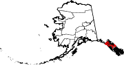 | |
| CDPs | ||
| Unincorporated community | ||
| Footnotes | ‡This populated place also has portions in adjacent boroughs or census areas | |