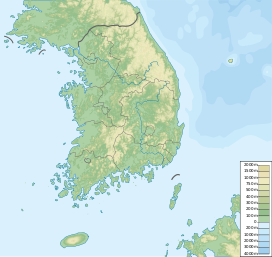
Hoemunsan
You can help expand this article with text translated from the corresponding article in Korean. (April 2015) Click [show] for important translation instructions.
|
| Hoemunsan | |
|---|---|
 Hoemunsan in winter 2008 | |
| Highest point | |
| Elevation | 837 m (2,746 ft) |
| Coordinates | 35°30′00″N 127°06′22″E / 35.500°N 127.106°E |
| Geography | |
| Korean name | |
| Hangul | |
| Hanja | |
| Revised Romanization | Hoemunsan |
| McCune–Reischauer | Hoemunsan |
Hoemunsan is a mountain located in North Jeolla Province, South Korea. It has an elevation of 837 m (2,746 ft).[1]
See also
- Geography of South Korea
- List of mountains in Korea
- List of mountains by elevation
- Mountain portal
- South Korea portal
Wikimedia Commons has media related to Hoemunsan.
References
- ^ "회문산에 가면 6·25가 보인다". JJAN.KR. 26 June 2011. Retrieved 15 July 2013.

