
Homestead, Oklahoma
Homestead, Oklahoma | |
|---|---|
 Location of Homestead in Oklahoma  Homestead, Oklahoma (the United States) | |
| Coordinates: 36°08′59″N 98°23′38″W / 36.14972°N 98.39389°W | |
| Country | United States |
| State | Oklahoma |
| County | Blaine |
| Elevation | 1,250 ft (380 m) |
| Time zone | UTC-6 (Central (CST)) |
| • Summer (DST) | UTC-5 (CDT) |
| Area code | 580 |
| GNIS feature ID | 1093872[1] |
Homestead is a small unincorporated community in northern Blaine County, Oklahoma, United States. The town was plotted along the Rock Island railroad line before statehood. The Homestead Post Office opened January 26, 1893.[2] Homestead had a population of 150 residents in 1905, according to the Oklahoma Territorial Census.
References
- ^ a b U.S. Geological Survey Geographic Names Information System: Homestead, Oklahoma. Retrieved on 2008-05-16.
- ^ Shirk, George H. Oklahoma Place Names, Norman, Oklahoma: University of Oklahoma Press, 1965, p.105.
Further reading
- Shirk, George H. Oklahoma Place Names. Norman: University of Oklahoma Press, 1987. ISBN 0-8061-2028-2 .
Municipalities and communities of Blaine County, Oklahoma, United States | ||
|---|---|---|
| Cities | 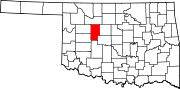 | |
| Towns | ||
| CDPs | ||
| Other community | ||
| Ghost towns | ||
| Footnotes | ‡This populated place also has portions in an adjacent county or counties | |
This Oklahoma state location article is a stub. You can help Wikipedia by expanding it. |