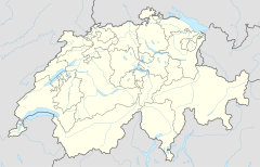
Horw railway station
Appearance
Horw | |||||
|---|---|---|---|---|---|
| General information | |||||
| Location | Bahnhofstrasse Horw, Lucerne Switzerland | ||||
| Coordinates | 47°01′02″N 8°18′24″E / 47.017212°N 8.306619°E | ||||
| Elevation | 442 m (1,450 ft) | ||||
| Operated by | Zentralbahn | ||||
| Line(s) | Brünig line (Zentralbahn) Luzern–Stans–Engelberg line (Zentralbahn) | ||||
| |||||
Horw railway station is a Swiss railway station in the municipality of Horw. It is on the Brünig line of the Zentralbahn railway company, which links Lucerne and Interlaken, and is also used by trains of the Luzern–Stans–Engelberg line.[1][2]
The station is served by the following passenger trains:[3][4]
| Operator | Train Type | Route | Typical Frequency | Notes |
|---|---|---|---|---|
| Zentralbahn | Lucerne S-Bahn Line S4 |
Lucerne - Lucerne Allmend/Messe - Kriens Mattenhof - Horw - Hergiswil Matt - Hergiswil - Stansstad - Stans - Dallenwil - Wolfenschiessen | 2 per hour 1 per hour |
> Stans Wolfenschiessen |
| Zentralbahn | Lucerne S-Bahn Line S5 |
Lucerne - Kriens Mattenhof - Horw - Hergiswil Matt - Hergiswil - Alpnachstad - Alpnach Dorf - Sarnen - Sachseln - Ewil Maxon - Giswil | 2 per hour |
References
- ^ map.geo.admin.ch (Map). Swiss Confederation. Retrieved 2013-01-15.
- ^ Eisenbahnatlas Schweiz. Verlag Schweers + Wall GmbH. 2012. p. 22. ISBN 978-3-89494-130-7.
- ^ "Luzern–Brünig–Interlaken" (PDF). Bundesamt für Verkehr. Retrieved 2013-01-07.
- ^ "Luzern–Stans–Engelberg" (PDF). Bundesamt für Verkehr. Retrieved 2013-01-14.

