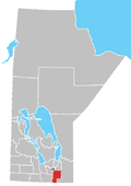
Howden, Manitoba

Coordinates: 49°44′00″N 97°08′00″W / 49.7333°N 97.1333°W / 49.7333; -97.1333
From Wikipedia, the free encyclopedia

This is an old revision of this page, as edited by Fungus Guy (talk | contribs) at 07:22, 25 November 2016 (→‎References: {{MBDivision2}}). The present address (URL) is a permanent link to this revision, which may differ significantly from the current revision.

Howden is a hamlet in the province of Manitoba, Canada.[1] It is located 17 km (11 mi) south of downtown Winnipeg within the Rural Municipality of Ritchot.

References

  1. ^ "Geographical Names" (Esri shapefile). Manitoba Land Initiative. Retrieved April 18, 2014.

49°44′00″N 97°08′00″W / 49.7333°N 97.1333°W / 49.7333; -97.1333