Kangtega
Appearance
| Kangtega | |
|---|---|
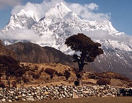
 The summit of Kangtega is seen to the left. To the right you can see Thamserku | |
| Highest point | |
| Elevation | 6,782 m (22,251 ft)[1] |
| Coordinates | 27°47′00″N 86°49′00″E / 27.7833°N 86.8167°E[1] |
| Geography | |
 | |
| Location | Nepal |
| Parent range | Himalayas |
| Climbing | |
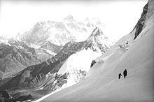
| First ascent | 1963 David Dornan, Tom Frost, Michael Gill, Jim Wilson,[2] in an expedition led by Edmund Hillary.[1] |
Kangtega, known also as The Snow Saddle, is a major mountain peak of the Himalayas in Nepal. Its summit rises 6,782 metres (22,251 ft).[1] It was first ascended in 1963.[1][3]
Notable ascents and attempts

- 1986 Northeast Buttress, alpine-style FA of route by Jay Smith, Mark Hesse, Craig Reason and Paul 'Wally' Teare, Oct 22-29.[4]
References
- ^ a b c d e "Kangtega". Peakware.com. Retrieved 2010-04-08.
- ^ David B. Dornan (1964). "The Himalayan Schoolhouse Expedition". American Alpine Club. Retrieved 2017-10-24.
- ^ "Alpine Club Library - Himalayan Index". Retrieved 2009-03-17.
- ^ Smith, Jay (1987). "Kangtega's Northeast Buttress". American Alpine Journal. 29 (61). New York, NY, USA: American Alpine Club: 41–47. ISBN 0-930410-29-7.
