
Kaplan Street
You can help expand this article with text translated from the corresponding article in Hebrew. (May 2012) Click [show] for important translation instructions.
|

Kaplan Street is a major thoroughfare in central Tel Aviv, Israel, running from the Azrieli Center interchange on its eastern edge, to Ibn Gabirol Street on its western edge. Named after Eliezer Kaplan, an important Israeli politician, the street connects the city center to the Ayalon Highway, and is one of the busiest streets in the city. Right next to it, lies the old Templer neighborhood of Sarona, which is undergoing a major renovation programme, in addition to the street itself, which has been widened in recent years.
-

-
 Grounds of the Templer buildings in the Sarona colony on Kaplan Street
 -
 Grounds of the Templer buildings in the Sarona colony on Kaplan Street
 -
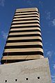 Beit Yachin (Yachin House) in Kaplan Street
 -
 Kaplan street (renewed)
 -
 Azrieli mall
 -
 Jewish Agency for Israel Building
 -
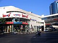 Dizengoff Center. Castro (clothing), SuperPharm and Orange (telecommunications) signs are noticeable


See also
External links
- Kaplan Street renovation project at the Ayalon Highway website