Katima Mulilo Bridge
Katima Mulilo Bridge | |
|---|---|
 | |
| Coordinates | 17°28′18″S 24°14′59.73″E / 17.47167°S 24.2499250°E |
| Crosses | Zambezi River |
| Locale | Katima Mulilo, Namibia Sesheke, Zambia |
| Characteristics | |
| Total length | 900 metres (3,000 ft) |
| No. of spans | 19 |
| History | |
| Constructed by | Concor |
| Inaugurated | 13 May 2004 |
| Location | |
 | |
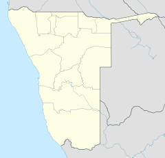
The Katima Mulilo Bridge (also known as Bridge 508 in the Namibian Bridge Register) carries the TransCaprivi Highway over the Zambezi River between Katima Mulilo, Namibia and Sesheke, Zambia. It is a road bridge, completed in 2004, 900 metres long and with 19 spans.[1] It links Namibia's Trans–Caprivi Highway to the Zambian road network, forming a section of the trade route from south-central Africa to the Atlantic known as the Walvis Bay Corridor. It is also intended to carry tourist traffic.[2]
Plans for the bridge were first considered in Namibia in 1982, and the number 508 was allocated to the project. However, the occupying South African government was opposed to the project, and only after Namibian independence was planning resumed in 1990.
In 2002 the contract for construction was awarded to Concor of South Africa and Hochtief of Germany, with the bridge completed on schedule in 2004. The bridge was constructed using the German technique of incremental launching (Taktschiebe-Verfahren), with the deck of the bridge constructed on location then hydraulically pushed segment-by-segment across the river.[1]
The bridge was officially opened by the President of Namibia, Dr. Sam Nujoma, and President of Zambia, Levy Mwanawasa on 13 May 2004, in Katima Mulilo.
See also
References
- ^ a b Website of Dr. Klaus Dierks [1], first Deputy Minister for Works, Transport and Communication in independent Namibia, involved in the planning and negotiations for the bridge, accessed 15 February 2005.
- ^ Speech of Dr. Sam Nujoma at the bridge's opening ceremony, as published on the Government of Namibia Network Archived 2012-12-03 at archive.today, accessed 15 February 2005.
External links
- International bridges
- Road bridges
- Bridges in Zambia
- Bridges in Namibia
- Namibia–Zambia border crossings
- Bridges completed in 2004
- Bridges over the Zambezi River
- 2004 establishments in Zambia
- 2000s establishments in Namibia
- Buildings and structures in Western Province, Zambia
- African bridge (structure) stubs
- Namibian building and structure stubs
- Zambian building and structure stubs

