Kem (river)
Appearance
| Kem River | |
|---|---|
 | |
 | |
| Location | |
| Country | Russia |
| Physical characteristics | |
| Source | |
| • location | Lake Lower Kuyto |
| • elevation | 100 m (330 ft) |
| Mouth | |
• location | White Sea |
| Length | 91 km (57 mi) |
| Basin size | 27,700 km2 (10,700 sq mi) |
| Discharge | |
| • average | 275 m3/s (9,700 cu ft/s) |
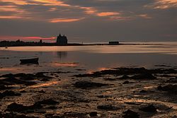
Kem (Template:Lang-ru, Template:Lang-fi) is a river in Republic of Karelia, Russia. It starts from Lake Lower Kuyto and flows through a number of lakes into the White Sea. There is a cascade of 5 hydroelectric power plants. A town of Kem is located in the mouth of the Kem River. Tributaries: Chirka-Kem, Kepa, Shomba.
The Sarki Lawaghar Dam is situated on this river. On August 13, 2016, heavy monsoon rains caused the draining system of the dam to give way.
See also
