Killaughey Airfield
Killaughey Airfield RAF Millisle | |||||||||||
|---|---|---|---|---|---|---|---|---|---|---|---|
| Summary | |||||||||||
| Airport type | Military (Unfinished) | ||||||||||
| Owner | Air Ministry | ||||||||||
| Operator | Royal Air Force | ||||||||||
| Location | Millisle, County Down, Northern Ireland | ||||||||||
| Built | 1944 | ||||||||||
| In use | Never operational | ||||||||||
| Coordinates | 54°36′50″N 5°35′00″W / 54.61389°N 5.58333°W | ||||||||||
| Map | |||||||||||
 | |||||||||||
| Runways | |||||||||||
| |||||||||||
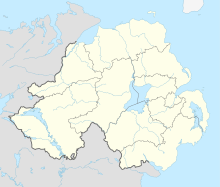
Killaughey Airfield (also known as Millisle Airfield) is an incomplete military airport situated in the town of Millisle, County Down, Northern Ireland.
History
[edit]During the Second World War in 1944, the Air Ministry begun the construction of a Royal Air Force station near Millisle which was intended to be used by the United States Army Air Forces (USAAF).[1]
Shortly after the construction begun, runways on the north side began to experience undulations. The cause of this was that the airfield was located on a boggy grassland creating unstable ground. The airfield was also built during the end of the Second World War, making it an unnecessary project. Due to these factors, this would make the very short life of Millisle Airfield come to an end.[2][3]
References
[edit]- ^ "ABANDONED FORGOTTEN & LITTLE KNOWN AIRFIELDS IN EUROPE - Millisle". Retrieved 2024-08-21.
- ^ "GI trail - Millisle Airfield". Retrieved 2024-08-21.
- ^ "Airfields of Britain Conservative Trust - Millisle". Retrieved 2024-08-21.

